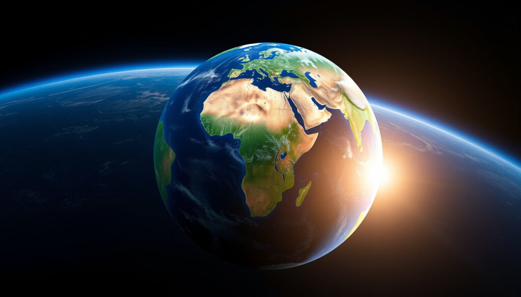
Continents of the World: 7 Main Ones, Sizes & Facts
Most of us grew up memorizing seven landmasses—only to discover later that geologists quietly argue about an eighth hidden continent mostly submerged beneath the Pacific. Zealandia, roughly the size of India, sits 94% underwater and only became officially recognized in 2017. Meanwhile, whether you call the smallest landmass “Australia” or “Oceania” depends on which side of a textbook you own. Here’s what science actually agrees on, what remains disputed, and why it matters for maps you’re already using.
Standard number: 7 · Largest by area: Asia · Smallest by area: Australia · Third largest: North America · Continents with countries: 6
Quick snapshot
- Asia is the largest continent at 31,033,131 km² (Worldometer continent data)
- Australia is the smallest at 7,617,930 km² (Wikipedia continent article)
- 7 continents are standard in English-speaking education (Wikipedia continent article)
- Whether Oceania should replace Australia as the seventh continent (Wikipedia continent definitions)
- Zealandia’s acceptance varies across scientific communities (GSA Today Zealandia study)
- Some models merge Europe and Asia into “Eurasia” (Wikipedia continent models)
- 1995: Geologist Bruce Luyendyk coins the name “Zealandia” (GSA Today journal)
- 2017: Study classifies Zealandia as Earth’s eighth continent (GNS Science news release)
- 2023: Zealandia becomes first continent to be fully mapped (GNS Science announcement)
- Oceania may gain broader recognition as a distinct continent (Worldometer regional data)
- Zealandia’s status could influence maritime boundaries for New Zealand (EBSCO geology resource)
- Textbooks and apps will need updates as consensus shifts (Wikipedia educational standards)
| Label | Value |
|---|---|
| Recognized continents | 7 |
| Total land area covered | 148 million km² |
| Most populous | Asia (4.7 billion) |
| Least populous | Antarctica (5,000 seasonal) |
| Transcontinental example | Russia |
What are the 7 continents of the world?
The seven continents recognized in most English-speaking countries, listed from largest to smallest by area, are Asia, Africa, North America, South America, Antarctica, Europe, and Australia (Wikipedia). These divisions blend geological boundaries with historical and cultural conventions, which is why the list looks different depending on where you went to school.
Asia
Asia covers approximately 31,033,131 km², making it the largest continent on Earth by both area and population (Worldometer). It contains 48 countries and is home to roughly 4.7 billion people, including the world’s two most populous nations: China and India. Asia spans from the Arctic Circle to the Indonesian archipelago, stretching across roughly 8,000 kilometers east to west.
Africa
Africa spans 29,648,481 km² and holds the title of second-largest continent (Worldometer). With 54 countries—the most of any continent—Africa also contains the Sahara Desert, the Nile River, and the Congo Basin rainforest. Its population growth rate is among the fastest globally, with projections showing it could host over 2.5 billion people by 2050.
North America
North America covers 21,329,947 km² across 23 countries (Worldometer). The continent stretches from the Arctic archipelago of Canada to the tropical rainforests of Panama, encompassing every climate type from tundra to rainforest. It includes the world’s largest freshwater system, the Great Lakes, and the longest mountain range, the Rocky Mountains.
South America
South America measures 17,461,112 km² and contains 12 countries (Worldometer). The continent is defined by the Andes Mountains, the Amazon River (the largest by discharge volume), and the Amazon rainforest—the largest tropical rainforest on Earth. South America also features the driest place on the planet, the Atacama Desert.
Antarctica
Antarctica spans 13,720,000 km² but has no permanent residents—only about 5,000 seasonal researchers man international stations (Worldometer). The continent holds roughly 70% of Earth’s fresh water in its ice sheets and has an average elevation higher than any other continent due to the massive ice cover.
Europe
Europe covers approximately 22,134,710 km² across 44 countries (Worldometer). Despite being the second-smallest continent by area, Europe has one of the highest population densities. Its boundaries are entirely conventional—there’s no geological border separating Europe from Asia, which some geologists combine into a single landmass called “Eurasia.”
Australia
Australia is the smallest of the seven traditional continents at 7,617,930 km² (Wikipedia). The Australian landmass is also the only continent entirely contained within a single country. Australia/Oceania has the lowest population density among inhabited continents at roughly 5 people per km² (Worldometer).
Do we have 7 or 8 continents?
The widely taught seven-continent model faces a geological challenge: Zealandia. In 2017, a study published in GSA Today by geologists from New Zealand, New Caledonia, and Australia classified Zealandia as a continent—the eighth one (GNS Science). Zealandia covers 4.9 million km², comparable to greater India, and meets the geological criteria for continent status: elevated above oceanic crust, diverse rock types, thick crust, and well-defined limits spanning over 1 million km² (GSA Today).
The catch is that 94-95% of Zealandia sits submerged beneath the Pacific Ocean (Bruce Luyendyk). Only 5% remains above water, forming New Zealand and New Caledonia—the only parts geologically considered “continents” until recently. Geologist Nick Mortimer put it plainly: “If it were not for the ocean level, it would have been recognised as such long ago” (Wikipedia).
Students memorizing continent names will likely stick with seven for now, but geology textbooks increasingly mention Zealandia as the “hidden continent” that challenges our conventional maps.
Standard model of 7
Most English-speaking educational systems teach seven continents because this model aligns with common usage and simplifies regional geography. The United States, United Kingdom, Canada, China, India, and most Western European nations use this system (Wikipedia). Seven works as a mnemonic device and matches how most atlases organize their regional sections.
Debate over 8 including Zealandia
Geological models sometimes recognize seven continental divisions: Africa, Antarctica, Australia, Eurasia (Europe and Asia combined), North America, South America, and Zealandia (Wikipedia). This model merges Europe and Asia due to their continuous landmass but elevates Zealandia based on crustal criteria. Some scientists argue that continent count depends on whether you prioritize cultural borders (the seven-model approach) or crustal geology (which supports eight).
Is Oceania a continent?
Oceania is best understood as a geographic region rather than a continent in the strictest geological sense. The term, used widely in the Pacific, encompasses Australia, New Zealand, Melanesia, Micronesia, and Polynesia, with a total area of 8,486,460 km² (Worldometer). Encyclopaedia Britannica defines Oceania as including Australasia, Melanesia, Micronesia, and Polynesia (Wikipedia). The confusion arises because some models replace “Australia” with “Oceania” as the seventh continent, arguing this better represents the Pacific island chain.
Weather apps and news services frequently label the Australian region as “Oceania,” creating a disconnect with school geography where Australia is the continent. Understanding which model a source uses helps navigate maps and regional data.
Oceania vs Australia distinction
Australia refers specifically to the continental landmass of 7,617,930 km². Oceania includes that landmass plus thousands of Pacific islands. The practical difference: “Oceania” captures the broader Pacific political and cultural region, while “Australia” identifies the continental plate. Some atlases use both names interchangeably as continent labels.
Cultural and geological views
Cultural geographers often prefer “Oceania” because it acknowledges Pacific island nations that Australia-as-continent excludes. Geologists, however, typically treat the Australian continent as the tectonic plate, which extends beyond the political boundaries of Australia into parts of New Guinea. This tectonic definition supports keeping “Australia” as the continent name rather than “Oceania.”
Is Australia a continent?
Yes, Australia is universally recognized as a continent—the smallest of the seven traditional continents (Wikipedia). Its status is unambiguous geologically: it’s a distinct continental plate separate from Asia, Africa, or any other landmass. The Australian landmass measures 7,617,930 km² or roughly 3 million square miles.
Geological status
Australia sits on its own tectonic plate, the Australian Plate. This plate actually extends beyond the country’s land boundaries to include parts of New Guinea and New Zealand—geological territory that falls under the same crustal structure. The continent’s separation from Asia by the Timor and Arafura Seas creates a clear oceanic boundary on three sides.
Size and isolation
Australia’s isolation is a defining characteristic. It’s the only continent entirely surrounded by water on all sides and is the smallest, flattest, and driest of the inhabited continents. Its size comparison reveals an interesting contrast: Greenland, at 2,166,086 km², is classified as an island despite being larger than most countries—because Australia meets the geological threshold for continent status while Greenland does not (Wikipedia).
What are the 2 lost continents?
The two most significant “lost continents” in geological literature are Zealandia and Greater Antarctica. Zealandia, the more prominent and now widely recognized one, spans approximately 4.9 million km² and was once connected to Antarctica (GSA Today). The term “lost” here doesn’t mean these continents no longer exist—they’re still there—but that they were once connected to supercontinents before breaking apart hundreds of millions of years ago.
Zealandia is Earth’s most recently identified continent, yet it was always there—just 94% underwater. “Lost” in geology often means “hiding in plain sight.”
Zealandia
Zealandia was proposed as a name by geologist Bruce Luyendyk in 1995 for the region including New Zealand, Chatham Rise, Campbell Plateau, and Lord Howe Rise (GSA Today). In 2017, a landmark paper in GSA Today by Mortimer et al. provided definitive criteria for classifying Zealandia as a continent. A 2021 study confirmed that Zealandia contains Precambrian rocks over a billion years old, further supporting its continent status (Wikipedia).
On October 9, 2023, Zealandia became the first continent to be completely mapped, including its geology, volcanoes, and sedimentary basins (GNS Science). The mapping revealed a giant volcanic region the size of New Zealand itself. Zealandia originated from the breakup of Gondwana around 180 million years ago (EBSCO).
Other submerged lands
Beyond Zealandia, several microcontinents and submerged plateaus exist that meet some but not all continent criteria. The Ontong Java Plateau, for instance, is one of the largest large igneous provinces on Earth but isn’t considered a continent. Other candidates include the Kerguelen Plateau and the broken fragments of Gondwana scattered across the Pacific and Indian Oceans.
Clarity on what we know versus what’s debated
Confirmed facts
- 7 continents model is standard in English-speaking education
- Asia is largest by area at 31,033,131 km²
- Australia is smallest at 7,617,930 km²
- Zealandia was proposed in 1995 and classified as a continent in 2017
- Zealandia is 94-95% submerged under the Pacific Ocean
- On October 9, 2023, Zealandia became the first continent to be fully mapped
What’s still debated
- Whether to include Zealandia in continent counts for education
- Whether “Oceania” should replace “Australia” as the seventh continent
- Whether to merge Europe and Asia into “Eurasia”
- Full extent of Zealandia’s Precambrian rock foundation
- How maritime law will be affected by Zealandia’s recognition
Expert perspectives
“Zealandia is everywhere substantially elevated above the surrounding oceanic crust.”
— GSA Today authors, geologists from New Zealand, New Caledonia, and Australia (GSA Today journal)
“If it were not for the ocean level, it would have been recognised as such long ago.”
— Nick Mortimer, geologist who led the 2017 Zealandia classification study (Wikipedia Zealandia)
“Zealandia just became the first continent to be completely mapped.”
— GNS Science, New Zealand government research institute (GNS Science news)
Summary
The seven-continent model serves education and navigation well, but geology tells a more complex story. Zealandia’s recognition as Earth’s eighth continent in 2017—and its complete mapping in 2023—demonstrates that our world maps are still being finalized. For mapmakers, app developers, and educators, the practical question is whether to update current seven-model products or wait for broader consensus to form. The risk of lagging is outdated content; the risk of rushing is confusing users who learned “seven continents” in school.
Related reading: Current Events in the World Today: Top Headlines & Issues · Current Events in the World: Ukraine, NATO, Hormuz
While textbooks highlight seven continents from vast Asia to tiny Australia, 7 continents list by size also spotlights the intensifying Zealandia debate as a potential eighth.
Frequently asked questions
What is the largest continent in the world?
Asia is the largest continent by area, covering approximately 31,033,131 km². It also holds the world’s two most populous countries, China and India.
What is the smallest continent in the world?
Australia is the smallest continent, covering 7,617,930 km². It is also the only continent entirely contained within a single country.
Which is the third biggest continent?
North America ranks as the third-largest continent by area, spanning 21,329,947 km² across 23 countries.
What is the only country in two continents?
Russia spans both Europe and Asia, making it the most prominent transcontinental country. Turkey and Egypt also straddle continental boundaries.
How many countries per continent?
Africa has 54 countries (most of any continent), Europe has 44, Asia has 48, North America has 23, South America has 12, Australia/Oceania has 14, and Antarctica has none.
What are the oceans of the world?
Earth has five oceans: the Pacific (largest), Atlantic, Indian, Southern (Antarctic), and Arctic (smallest). They cover approximately 71% of Earth’s surface.
What are subcontinents?
A subcontinent is a large, distinct landmass that is geologically separate from the main continent. The Indian subcontinent is the most commonly referenced example, referring to the peninsular region south of the Himalayas.
More related posts
 Why Is Savannah Guthrie Trending Today? Mother Missing
 Lobster Roll Near Me Dublin: Cost, Season & Best Spots
 Oklahoma City Thunder vs Denver Nuggets: Score, Stats & Prediction
 How to Set Up Google Alerts: iPhone, Android & Web
 Sammy Steal a Brainrot: Real Name, Net Worth & Contact
 How to Find, Change & Reset Whirlpool Refrigerator Water Filter
 Floyd Roger Myers Jr. Dies at 42: Fresh Prince Child Actor
 How to Evolve Charcadet – Scarlet and Violet Guide
