Where Is Yosemite National Park? Location & Yellowstone Guide
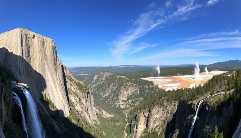
Yosemite Valley’s granite walls rise more than 3,000 feet straight up, and the first glimpse of El Capitan from the tunnel usually stops people mid-sentence — but even that breathtaking sight doesn’t tell you where the park actually sits or how it stacks up against Yellowstone, so here’s a detailed breakdown of its location, gateway cities, and a comparison between the two parks.
Total area: 1,200 sq mi (3,108 km²) · Established: October 1, 1890 · Annual visitors: ~4 million · Highest point: Mount Lyell (13,114 ft) · Major waterfalls: Yosemite Falls, Bridalveil Fall, Ribbon Fall
Quick snapshot
- Yosemite is located entirely within California (National Park Service – official park page)
- Established as a national park in 1890 (National Park Service – official park page) (National Park Service – official park page)
- Covers nearly 1,200 square miles (National Park Service – official park page) (National Park Service – official park page)
- Exact annual visitor counts fluctuate; the ~4 million figure is an estimate from the National Parks Conservation Association (National Parks Conservation Association – NPCA)
- Some boundary details on older maps may appear to cross into Nevada, but official sources confirm it does not (National Parks Conservation Association – NPCA)
- 1864: Yosemite Grant signed by President Lincoln, first state park (National Park Service – official park page) (Wikipedia article on Yosemite National Park)
- 1984: Designated UNESCO World Heritage Site (Wikipedia article on Yosemite National Park)
- Planning a trip? Check reservation requirements for peak months on the NPS website (National Park Service – places to go)
- Winter snow closes Tioga Road, so confirm road conditions before driving from the east (National Park Service – places to go)
Key facts about Yosemite at a glance:
| Fact | Detail |
|---|---|
| State | California, USA |
| Nearest City | El Portal (inside park boundary) |
| Size | 1,200 square miles (3,108 km²) |
| Highest Point | Mount Lyell (13,114 ft / 3,997 m) |
| Annual Visitors | Approximately 4 million |
| Main Gateway Airports | San Francisco (SFO), Sacramento (SMF), Fresno (FAT) |
Where is Yosemite National Park located?
Geographic coordinates and region
- Yosemite National Park sits in the central Sierra Nevada mountain range in California (National Park Service – official park page).
- Its coordinates are roughly 37.8651° N, 119.5383° W.
- The park spans four California counties: Tuolumne, Mariposa, Mono, and Madera (Wikipedia article on Yosemite National Park).
That location puts Yosemite about 200 miles east of San Francisco and 100 miles north of Fresno. The Sierra Nevada crest runs through the park’s eastern edge, giving it dramatic elevation changes.
Boundaries and neighboring lands
- To the southeast: Sierra National Forest (Wikipedia article on Yosemite National Park).
- To the northwest: Stanislaus National Forest.
- Nearly 95 percent of the park is designated wilderness (National Parks Conservation Association – NPCA).
Because 95% is wilderness, nearly all visitor activity funnels into Yosemite Valley — just 7 square miles of the park’s 1,200 — creating concentrated crowds during peak season.
The implication: Yosemite’s location within the Sierra Nevada gives it steep cliffs and deep valleys, a geography that is distinct from Yellowstone’s high plateau.
Is Yosemite in two states?
State boundaries explained
- Yosemite National Park is entirely within the state of California (National Park Service – official park page).
- No portion extends into Nevada or any other state.
- The confusion may arise because the park lies near the California-Nevada border (about 15 miles west of the state line at its closest), but all of its land is on the California side.
The trade-off: Even though Yosemite is fully in one state, the proximity to Nevada means travelers flying into Reno can reach the Tioga Pass entrance in about 3 hours — an option for visitors coming from the east.
What is the closest city to Yosemite?
Nearby towns and gateway cities
- El Portal — the closest community, located just inside the park’s western boundary on Highway 140 (Yosemite.com travel guide).
- Mariposa — about 37 miles west of Yosemite Valley, a common overnight stop.
- Oakhurst — roughly 26 miles south of the park’s south entrance (Highway 41).
- Groveland — about 32 miles west of the Big Oak Flat entrance (Highway 120).
- Fresno — the nearest major city, about 65 miles south; it has a regional airport and full services.
For many visitors, the closest major airport is Fresno Yosemite International (FAT), while San Francisco (SFO) and Sacramento (SMF) are larger hubs but require a 3–4 hour drive (National Park Service – places to go).
If you’re flying from the East Coast, Fresno cuts your drive time in half compared to flying into San Francisco. Sacramento offers a middle ground — about 2.5 hours to the park.
The pattern: Nearly all gateway towns sit west of the park, meaning most visitors approach from the California Central Valley.
Which one is better, Yellowstone or Yosemite?
Landscape differences
Yosemite and Yellowstone both rank among America’s most iconic national parks, but their geography creates fundamentally different experiences. Yosemite is defined by granite cliffs — El Capitan rises 3,000 feet above the valley floor, and Half Dome towers above the eastern end. Yellowstone, on the other hand, sits on a volcanic caldera and features sprawling geyser basins, hot springs, and the Grand Canyon of the Yellowstone.
- Yosemite covers about 1,200 square miles; Yellowstone covers more than 2.2 million acres (about 3,472 square miles) (National Park Service – Yellowstone homepage).
- Yosemite’s highest point is Mount Lyell (13,114 ft); Yellowstone’s highest is Eagle Peak (11,358 ft).
- Yosemite Valley is only 7 miles long and one mile wide — a compact wonderland. Yellowstone’s Grand Loop is 142 miles.
Wildlife and bears
- Yellowstone has both grizzly bears and black bears (National Park Service – Yellowstone homepage).
- Yosemite has black bears only. Grizzly bears are extinct in California (the last one was killed in 1924).
- Both parks offer excellent wildlife viewing, but Yellowstone’s larger ecosystem and grizzly population make it more famous for large mammals.
Visitor crowds and accessibility
- Yosemite draws about 4 million visitors annually (National Parks Conservation Association – NPCA).
- Yellowstone also gets about 4 million annually (National Park Service – Yellowstone homepage).
- Yosemite is more accessible from West Coast cities (3–6 hours from San Francisco, Sacramento, Fresno). Yellowstone is more remote, with the nearest major airports (Jackson Hole, Bozeman, Salt Lake City) 1.5–5 hours away.
One table clarifies the main contrasts:
| Feature | Yosemite National Park | Yellowstone National Park |
|---|---|---|
| State(s) | California only | Wyoming, Montana, Idaho |
| Size | ~1,200 sq mi | ~3,472 sq mi |
| Established | 1890 | 1872 (first national park) |
| Main geological feature | Granite cliffs, waterfalls | Volcanic caldera, geysers |
| Bear species | Black bears only | Grizzly and black bears |
| Nearest major airport | Fresno (65 mi) | Jackson Hole (60 mi) / Bozeman (90 mi) |
| Annual visitors (approx) | 4 million | 4 million |
Why is Yosemite so famous?
Iconic landmarks
- El Capitan — The National Parks Conservation Association calls it “the world’s tallest granite monolith” (National Parks Conservation Association (NPCA)).
- Half Dome — A granite dome that rises nearly 4,800 feet above Yosemite Valley.
- Yosemite Falls — At 2,425 feet, it’s one of the tallest waterfalls in North America (National Parks Conservation Association).
- Glacier Point — A viewpoint 3,200 feet above the valley floor with panoramic views.
- Mariposa Grove — Home to over 500 giant sequoias.
Photography and film history
Ansel Adams’ black-and-white photos of Yosemite in the early 20th century made the park a symbol of American wilderness. The park also appears in films like The Last of the Mohicans and Star Trek V. Tunnel View remains one of the most photographed scenes in the United States.
Climbing heritage
Yosemite Valley has been a global climbing mecca since the 1950s. The first ascent of the Nose on El Capitan in 1958 started a tradition that still draws elite climbers from around the world. Free solo ascents and speed records on the Nose continue to make headlines.
The combination of natural grandeur, historical significance, and accessible location makes Yosemite a world-class destination that continues to attract millions each year.
Timeline of Yosemite National Park
- 1864 – Yosemite Grant signed by President Abraham Lincoln, protecting the area as the first state park (National Park Service – official park page).
- 1890 – Designated as a national park (National Park Service – official park page).
- 1906 – Yosemite Valley and Mariposa Grove returned to federal control.
- 1913 – Hetch Hetchy dam begins — a controversial water project that floods a valley comparable to Yosemite Valley.
- 1984 – Designated a UNESCO World Heritage Site (Wikipedia article on Yosemite National Park).
These milestones show how Yosemite evolved from a state grant to an internationally recognized protected area.
Confirmed facts and what remains uncertain
Confirmed facts
- Yosemite is entirely in California (National Park Service – official park page).
- El Capitan is the world’s tallest granite monolith (National Parks Conservation Association (NPCA)).
What’s unclear
- Exact annual visitor numbers vary; use NPS data for the most recent count (NPCA estimates ~4 million).
- Some older maps show boundary lines near the state border that could be misinterpreted, but official maps confirm the park stays in California.
- Exact driving time from San Francisco varies; ~4 hours is an estimate.
- Black bears are present but grizzlies are extinct in California; no recent confirmed sightings.
Even with reliable sources, a few details remain approximate, so always check the most current NPS data before planning.
What travelers are saying
“Yosemite Valley is accessible by car year-round and is world famous for its waterfalls, meadows, cliffs, and unusual rock formations.”
— National Park Service, official website (places to go)
“Almost 95 percent of Yosemite National Park is designated wilderness.”
— National Parks Conservation Association, NPCA park profile
“Yellowstone is the world’s first national park, established in 1872.”
— National Park Service, Yellowstone homepage
The consistent praise from official sources underscores the parks’ unique appeal and the importance of advance planning.
Summary: The decision between Yosemite and Yellowstone
Yosemite sits in California’s Sierra Nevada, a compact park of towering cliffs and iconic waterfalls that is remarkably easy to reach from the state’s major cities. Yellowstone sprawls across three states with a volcanic landscape unlike anything else on the continent. For a West Coast traveler who values drive time and vertical scenery, Yosemite is the obvious pick. For someone willing to travel farther and spend more days exploring, Yellowstone offers a greater diversity of ecosystems and the rare chance to see grizzly bears in the wild. The choice comes down to what kind of wild you want to experience.
For a traveler based in San Francisco, the 3.5-hour drive to Yosemite Valley makes it a feasible long-weekend trip. For a traveler flying from Europe or Asia, the combination of Yosemite and a second California park (Sequoia & Kings Canyon) could be a better itinerary than a single park in Wyoming. Travelers should let their available time and appetite for driving dictate which park they visit.
Frequently asked questions
How do I get to Yosemite National Park?
Fly to San Francisco (SFO), Sacramento (SMF), or Fresno (FAT), then drive 3–6 hours depending on your gateway. There is no direct rail service to the park; Amtrak stops in Merced, where a bus connection runs to Yosemite.
Do I need a reservation to enter Yosemite?
During peak summer months (typically May through October), a day-use reservation is required for vehicles entering Yosemite Valley. Check the NPS website for the current reservation system.
What is the best time of year to visit Yosemite?
May through October offers warm weather and full access to all roads and trails. Winter brings fewer crowds but snow can close Tioga Road and Glacier Point Road.
Are there any entrance fees?
Yes. As of 2025, the entrance fee for a private vehicle is $35 (valid for 7 days). An annual Yosemite Pass costs $70. The America the Beautiful Pass also covers entry.
Can I see Yosemite in one day?
It is possible but tight. A single day allows you to drive Yosemite Valley, stop at Tunnel View and Glacier Point, and see the major waterfalls. To hike Half Dome or explore Tuolumne Meadows, plan at least two full days.
What should I pack for a trip to Yosemite?
Layers (weather can change quickly), sturdy walking shoes, a reusable water bottle, sunscreen, bear spray (for hiking in bear country), and a flashlight or headlamp.
Is Yosemite open year-round?
Yes, the park is open 365 days a year. However, some roads and facilities close during winter. Yosemite Valley remains accessible by Highway 140 (the all-weather entrance).
More related posts
 7/8 as a Decimal: Complete Conversion Guide with Steps
 Sammy Steal a Brainrot: Real Name, Net Worth & Contact
 Packers vs Cowboys Stats: All-Time Record & 2025 Tie
 Ralph Lauren Bear Sweater: Styles, Authenticity, and Buying Guide
 Voting Rights Act of 1965: Definition, Impact, and Importance
 Call Me by Your Name: Plot, Meaning & Key Scenes Explained
 Best Breakfast Sandwiches Near Me in Dublin: Guide
 Folate vs Folic Acid: Differences, Sources, and Pregnancy Use
